Day five of my 16-day/335km section hike from Northcliffe to Albany on the Bibbulmun Track.
Distance: 21.8km direct, 23.3km with optional Mount Pingerup diversion.
Terrain: Flat, with an optional climb up Mount Pingerup.

I’d pitched my tent at one of the sites behind Mount Chance shelter, at a spot ensconced in the thick bush. Massive karri trees were all around the shelter and the tent sites, their huge branches intertwining to form a thick canopy that filters the moonlight to the forest floor. I tried not to think about how quickly I’d be turned into a human crepe if the wrong branch decided to dislodge itself in the vicinity of my tent in the middle of the night. Ouch. The thought didn’t keep me from sleeping and I woke in the early dawn after a restful night, keen to see the sunrise at the top of the mount after yesterday’s spectacular sunset. It was even better.
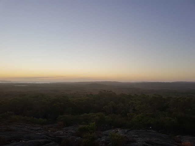
A blanket of cool mist had descended on the plains that Bonny and I had spent yesterday traversing, and we watched it flow like a river along the valley floor. Broke Inlet was also visible far off in the distance, our first hint that we were getting closer to the South Coast.
We lingered on top of the massive granite dome that is Mount Chance for 15 minutes or so, soaking in the view and taking advantage of the phone reception to check the forecast and messages from home. Then a quick breakfast, and we set off. The day’s walk started much the way yesterday’s had ended, with more overgrown open plains interspersed with islands of jarrah forest.

More beautiful swamp bottle brushes were our occasional companions, lighting up the trail in brilliant red.

This area felt about as remote as it gets on the Bibbulmun Track, as the track itself was the only sign of human interference for many kilometres. The firm, level track made for some very easy walking, and I found a decent rhythm pretty quickly. I was so in the zone, I made it the entire 7.8km to the junction with the Mount Pingerup walk trail without once checking my watch. That must be a personal record.
After turning right onto the Mount Pingerup walk trail, the track gradually ascends for a couple of hundred metres before turning off it and going back down the mount. I’d gone ahead of Bonny but we’d agreed it would be a huge waste to make it all the way out here and not climb Mount Pingerup, so I drew a (hopefully) obvious arrow on the ground pointing to the summit and headed up the spur trail. After 750 metres of sweating my way up an increasingly steep 4WD track, then walking track, then several sets of stairs, I reached the summit with a soaked shirt. I hung it over a rock to dry, and took in the incredible views.

I bummed around for a bit until Bonny showed up about 20 minutes later (she’s much more thorough about taking pictures, something I regret not doing as much for the first week of the walk). I was about ready to leave by the time Bonny arrived, so we made plans to stop for lunch at another “substantial footbridge” noted in the guidebook, another 8km down the track. After descending the mount, the track soon returned to the Pingerup plains and wound its way around and through yet-more stands of jarrah.

The trees became thicker and the track more shaded after I crossed Broke Inlet Road, culminating in a bizarre section of no more than a few hundred metres where half the trees appeared to have been blown over by an extremely localised storm. Perhaps they were disturbed by a UFO landing.
Not long after I made it to our lunch spot – a footbridge crossing a stagnant but still-pretty creek. While I was making lunch (salami wrap with rehydrated hommus, yum) a tiny lizard popped it’s head up from between the boards about a metre in front of me, took one look and me and retreated. Seconds later he resurfaced one gap closer to me, and vanished again. He repeated the process a couple of times until he was right in front of my shoes, which must have smelled delicious or something.

Bonny joined Bob and I shortly after, and we (well, Bonny and I – not Bob) set off for the last few kilometres to Woolbales campsite. We made it there by mid afternoon and met a couple of Victorian guys out on a northbound section hike.
Like Mount Chance, Woolbales shelter is right next to a massive granite dome you can climb for incredible views. The climb is a bit longer (which doesn’t really say much), but definitely worth it.
Broke Inlet was now clearly visible to the west, as were the massive hills of the Nuyts Wilderness in the far distance. We scrambled back down the hill for a quick dinner, so we could make it back up for sunset.
The silent atmosphere on the summit while the light faded was almost indescribable. There are moments on long hikes when you realise how lucky you are to be on such an incredible adventure, and this was one of them. I was conscious that I was experiencing a part of Western Australia that even most locals will never see, and that you can only ever see on a journey by foot. As the sun faded behind the horizon, the sky slowly lit up with stars and we were treated to a spectacular view of the Milky Way. I almost wished I had my camera and tripod to capture it, but being without them meant I had no option but to lie on the granite and point my eyes at the heavens.
Magic.


This was llovely to read